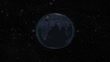
Flagge von Madagaskar und Karte von Madagaskar aus dem Weltraum auf die Erde gezoomt, Echtzeit-Fotoanimation. - 4K Stock-Video
In 4k quality, the Earth in space rotates and stops in Madagascar. As this animation takes place, in addition to the animation showing the day and night cycle, the camera approaches the country and the borders of the country are drawn and the Madagascar flag appears.


EINE LIZENZ KAUFEN
Alle Lizenzen für lizenzfreie Inhalte beinhalten weltweite Nutzungsrechte, umfangreichen Schutz und eine einfache Preisgestaltung mit Mengenrabatten
Fr. 500.00
CHF
DETAILS
Bildnachweis:
Creative #:
2164382450
Lizenztyp:
Kollektion:
Creatas Video
Max. Dateigröße:
3840 x 2160 px - 232 MB
Cliplänge:
00:00:21:05
Hochgeladen am:
Ort:
Turkey
Releaseangaben:
Keine Freigaben erforderlich
Gemastert mit:
MPEG-4 8-bit H.264 4K 3840x2160 30p
Kategorien:
- Kultur Madagaskars,
- 4K-Auflösung,
- Abstrakt,
- Ansicht aus erhöhter Perspektive,
- Astronomie,
- Befestigte Staatsgrenze,
- Beleuchtet,
- Blau,
- Daten,
- Digital generiert,
- Digitale Zeichentrickaufnahme,
- Draufsicht,
- Drehort außerhalb der USA,
- Dunkel,
- Echtzeit,
- Ereignis-Atmosphäre,
- Film - Filmtechnik,
- Flagge,
- Flagge Madagaskars,
- Flugzeugperspektive,
- GPS,
- Global,
- Globus,
- HD-Format,
- Heranzoomen,
- Horizontal,
- Internationale Grenze,
- Karte - Navigationsinstrument,
- Kartographie,
- Kugelform,
- Kulturen,
- Land,
- Land - Geografisches Gebiet,
- Licht,
- Nacht,
- Nahaufnahme,
- Nationalflagge,
- Physikalischer Zustand,
- Physische Geographie,
- Planet,
- Planet Erde,
- Reiseziel,
- Sehenswürdigkeit,
- Staatsgrenze,
- Standortverfolgung,
- Symbol,
- Technologie,
- Tourismus,
- Türkei,
- Weltall,
- Weltkarte,
- Weltraum und Astronomie,
- Wolke,
- Zeichentrickaufnahme,